Cordillera de Sama Biological Reserve
The itinerary I had chosen for visiting the Cordillera de Sama Biological Reserve turned out to be more complicated than anticipated. I had planned to cross the cordillera from east to west starting in Pinos Sur, but about halfway through the crossing of the mountains, I have not been able to continue...
Trail Toward Pinos Sur
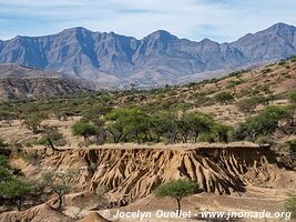
The first part of this excursion is a drive on a trail south of Pinos Sur. It is only a small dirt road, but it still offers some superb scenery.
Cordillera de Sama - western side
After having reached Pinos Sur, I enter the park and I start driving the long winding road that climbs more than 1000 metres in just a few kilometres.
Cordillera de Sama - Hamlet of Calderillas
I reach the hamlet of Calderillas located at about 16 kilometres inside the park boundaries, and I find out that the road ends up after a small school and it is impossible to continue to the western side of the park. The trail has not been maintained in years, and even 4x4 don't use it anymore.
I turn back and without thinking too much about it, I decide to drive around the south side of the park without suspecting that the journey will be long and that the path would be made of dirt and rock. Moreover, there was no accommodations in any of the communities I passed along the way. I had to sleep next to a river, but it didn't also go as planned.
Detour via the South Side of the Park
The day before, I had chosen to install the tent on a sandy patch next to the river. It is more comfortable than gravels, except when in the night, strong winds blow sand into the tent. The next day I woke up with a layer of sand on the floor and also in almost all the luggage bags I own... I even had left my toothbrush bag opened.
The next day, after a rough night, I pack my bags and I continue driving toward Copacabana located on the southwestern side of the reserve. The winds are very strong and the route pass through altitudes of more than 4000 metres, but I still manage to reach the park.
Cordillera de Sama - western side
In the area, one can enjoy the pretty dunes of Tajzara. During my visit, the sky was gray and the strong winds were lifting lots of sand, and it was difficult to take photos.
It was a cold day and even in the middle of the afternoon the lagunas and creeks were still partially frozen.
I tried to reach as far as I could in the direction of the hamlet of Calderillas in order to know how many kilometres I couldn't drive to link the eastern and western sides. Once I reached the end of the good road, I walked about 200 metres to investigate the state of the path and check if it was that bad.
On these photos, we see that the trail is quite rough and it would have been quite risky to drive it with a loaded motorcycle. I could see the hamlet at the bottom of the valley; there were only 8 kilometres left to reach it (3.5 km as the crow flies).
Cordillera de Sama - Iscayachi to Tarija
Finally, after a visit of the southwestern side of the reserve, I continue driving north until I reach Iscayachi. Then I cross the reserve once more until I reach Tarija.
It has been two long tiring days, but it was worth it for the magnificent landscapes.


