Molinos and its surroundings
Road from Angastaco to Molinos
I leave Angastaco and I continue driving on Ruta 40 in the direction of Molinos.
Molinos
I reach the small village of Molinos around noon. Once there, I notice that the mountains are less and less visible due to Zonda wind that brings lots of dust in the air. I decide to stop in the village of Molinos for the day.
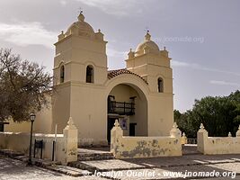
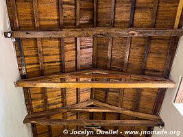
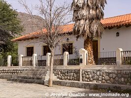
In the early afternoon, I walk around the village to admire some nice adobe houses (mud brick hardened in the sun), a colourful cemetery, and a church dating from the 17th century.
It was a good decision to stop here since at the end of the day there are strong winds and the sky is darkened by the dust. The mountains in the distance are barely visible.
Molinos - Colomé - Cuchiyaco - Brealito - Seclantás Trail
From Molinos, I leave Ruta 40 in order to follow a trail and discover the backcountry between Molinos and Seclantás.
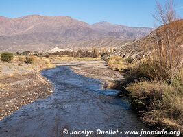
The first kilometres are very tough since I follow a dry river bed and the trail is only a path made of round stones. The motorbike front wheel deviates from the path, and I almost fell a dozen times. After about ten kilometres, I leave the river bed behind and I am very happy with myself.
Proud of having driven several kilometres on a difficult track without a fall and back on the main dirt road, I drive faster than usual and ironically I fell in a curve where there were cumulated sand over washboards. So typical, I manage to do the enduro section without any problem, and then I fall on the busier dirt road.
Canyon between Aguadita and Cuchiyaco
From the hamlet of Aguadita to Cuchiyaco, the trail goes through a magnificent canyon carved by the Molinos River.
Laguna de Brealito
The Laguna de Brealito, of volcanic origins, is located at an altitude of 2700 metres and has an average depth of 15 to 25 metres.


