Travels around the world 2009-2024
Exploring our beautiful planet
Latest news:
Where am I : Palmira (Mendoza), Argentina (April 11, 2025)
Most recent posts:
—
May 10, 2024 — Argentina
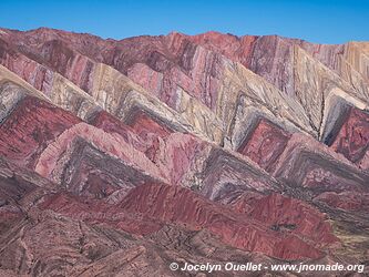
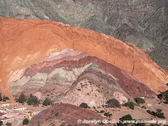
The Serrania del Hornocal is a spectacular site also known as the Cerro de los 14 colores, or 'Hill of 14 colours'. This landscape was formed millions...
—
May 9, 2024 — Argentina
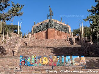
Humahuaca is a pretty village where you can base yourself to explore the sites of the Quebrada de Humahuaca. It was founded in 1594 and its name derives...
—
May 7, 2024 — Argentina
The Quebrada de Humahuaca is a 155-kilometre-long valley in the Andes mountain range. It is famous for its magnificent, colourful mountain scenery, its...
—
May 3, 2024 — Argentina
From Purmamarca, I took a short excursion to visit the Salinas Grandes. To get there, I crossed the Cuesta de Lipán, a road that climbs towards the...
—
May 1, 2024 — Argentina
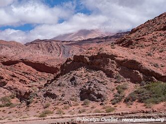
I'm back in the mountains, but this time I'm confining myself to the pre-cordillera and visiting the villages of the Quebrada de Humahuaca at an average...
—
Apr 30, 2024 — Argentina
In the last article, I was in San Antonio de las Cobres and had intended to discover several other places in the high mountains of Argentina. However...
—
Apr 27, 2024 — Argentina
San Antonio de los Cobres is a mining town in the province of Salta where I stayed for a few days to visit the surrounding area. It was an excellent...
—
Apr 25, 2024 — Argentina
Phew, the fantastic scenery never stops in this part of the country! All this scenery in a single day and two hundred kilometres of trails...
—
Apr 24, 2024 — Argentina
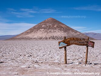
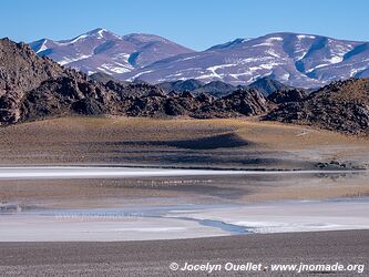
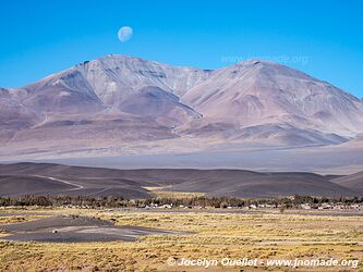
The Salar de Arizaro is less spectacular than its neighbour, the Salar de Antofalla, but it still has a very special feature. A volcano with almost perfect...
—
Apr 23, 2024 — Argentina
The Salar de Antofalla, in the province of Catamarca, boasts some fantastic landscapes. This 150-kilometre-long stretch of salt itself has many interesting...
—
Apr 22, 2024 — Argentina
A few kilometres south of the town of Antofagasta de la Sierra are two magnificent volcanoes. The older volcano, Antofagasta, erupted approximately 340,000...
—
Apr 20, 2024 — Argentina
An excursion to the Laguna Grande and Laguna Diamante is another spectacular activity to do from El Peñón. The route starts from the village at 3,400...
—
Apr 18, 2024 — Argentina
El Peñón is a small village in the province of Catamarca. In itself, the village would be quite ordinary were it not for the natural wonders that surround...
—
Apr 9, 2024 — Argentina
Route 76 leading to Laguna Brava is just as magnificent as the latter. I descend from an altitude of 4210 metres to San José de Vinchina at 1450 metres...
—
Apr 5, 2024 — Argentina
I'm taking a great leap forward in time! The last article recounted my adventures with the two Thierry in Bolivia in November 2022, and now I'm presenting...
—
Nov 1, 2022 — Bolivia
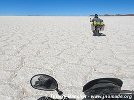
Here we are at the famous Salar de Uyuni. Even though I've already been to the salar in 2019 and also in 2005, I had to bring the two Thierry's, because...
—
Oct 27, 2022 — Bolivia
Laguna Coipasa, surrounded by the Salar de Coipasa, is a salt lake no more than 3.5 metres deep. It is difficult to access, as to get close you have to...
—
Oct 25, 2022 — Bolivia
We leave Sajama Park heading south. We drive all day at an altitude of over 4,000 metres. The semi-desert landscapes are beautiful despite their austerity...
—
Oct 23, 2022 — Bolivia
After two days at average altitudes below 2,500 metres, we're back on the Altiplano plateau. To get to Sajama, we had to do a lot of driving through a...
—
Oct 21, 2022 — Bolivia
After descending the Death Road, we drive for a while along the flanks of the Andes at altitudes ranging from 1,000 to 2,000 metres, before climbing to...
—
Oct 19, 2022 — Bolivia
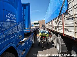
After crossing the border, we thread our way through the stationary trucks. A strike at the border crossing brought freight truckers to a standstill...
—
Oct 17, 2022 — Peru
Puno is a small town on the shores of Lake Titicaca. At an altitude of 3,820 metres, the climate is cool but pleasant. We made a brief stop there for...
—
Oct 15, 2022 — Peru
We've been travelling through the high mountains of Peru for a week now. The scenery is often breathtaking, yet we've seen no other travellers on these...
—
Oct 11, 2022 — Peru
We continue our journey through the Peruvian countryside, taking in some magnificent scenery...
—
Oct 9, 2022 — Peru
I continue my journey with the two Thierry on high mountain trails. As you can see from the photo, we're at a pass at almost 4,500 metres altitude. One...
—
Oct 7, 2022 — Peru
I've been wanting to explore Patagonia and Brazil for quite some time now. So why am I taking to the roads of Bolivia and Peru? Quite simply, to ride...
—
Oct 6, 2022 — Peru
The name Sóndor comes from «Suntur Wasi» in Quechua and means «house of the condor». It was built by the Chanka culture (AD 1000...
—
Sep 27, 2022 — Peru
Over a million people visit Cusco and the famous Machu Picchu every year. Despite this incredible number, I saw virtually no tourists on my loop north...
—
Sep 24, 2022 — Peru
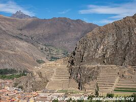
Ollantaytambo is an ancient Inca fortress and archaeological site located in Peru's Sacred Valley. A UNESCO World Heritage Site, it dates back to the...
—
Sep 23, 2022 — Peru
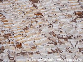
Salinas de Maras is a salt extraction site dating back to pre-Incan times. The site includes some three thousand terraced salt pans where mineral-rich...
—
Sep 22, 2022 — Peru
In addition to the ancient Inca ruins, Chinchero is also a large Peruvian village. Juxtaposed to the archaeological site, the Spaniards built a beautiful...
—
Sep 21, 2022 — Peru
Saqsaywaman, also called Sacsayhuamán, is an archaeological site located near Cusco. It was built during the 15th century. It served as a fortified complex...
—
Sep 19, 2022 — Peru
Tambomachay is an archaeological site of the Inca Empire. It is also known as El Baño del Inca or 'The Bath of the Inca'. It is formed by a series of...
—
Sep 17, 2022 — Peru
This archaeological site located 30 km east of Cusco is a fortress of ancient Peru dating back to the pre-Inca period. The site was an important place...
—
Sep 14, 2022 — Peru
After the jungle in Bolivia and Peru, it's a return to the Andes. Over a distance of less than 200 kilometres, I went from an altitude of 257 metres at...
—
Sep 6, 2022 — Peru
For 3 days I explored the Peruvian jungle in the Tambopata National Reserve. My main goal was to go to Collpa Chuncho where you can observe the beautiful...
—
Sep 4, 2022 — Peru
In Puerto Maldonado, I stayed at this small lodge before taking a trip into the jungle of the Tambopata National Reserve. It was a very quiet stay as...
—
Aug 28, 2022 — Bolivia
The far north of Bolivia was interesting despite the oppressive heat, humidity and dust on the roads. With temperatures hovering around 35 degrees Celsius...
—
Aug 23, 2022 — Bolivia
Travelling through the Amazon basin, I thought I was going to be riding on beautiful roads surrounded by lush rainforest and exotic animals. My experience...
—
Aug 10, 2022 — Bolivia
The seven Jesuit missions on this circuit were forgotten for over two centuries. In 1986, the release of the film The Mission, starring Robert de Niro...
—
Aug 8, 2022 — Bolivia
Santa Cruz has a population of about 1.9 million (3.8 million for the whole metropolitan area). It lies at the foot of the Andes Mountains, in the llanos...
—
Aug 5, 2022 — Bolivia
After three weeks in Tarija, I hit the road again in the Bolivian backcountry. I passed through roads not often used by travellers. In a few days, I drive...
—
Jul 20, 2022 — Bolivia
On the way out of the Cordillera de Sama, there are impressive views of the villages of San Lorenzo, Rancho Norte, San Mateo and the city of Tarija in...
—
Jul 11, 2022 — Bolivia
The itinerary I had chosen for visiting the Cordillera de Sama Biological Reserve turned out to be more complicated than anticipated. I had planned to...
—
Jul 10, 2022 — Bolivia
Small loop in the far south of the country, in the department of Tarija...
—
Jul 9, 2022 — Bolivia
The trail to the Tariquía Reserva climb about 1000 metres from the village of Padcaya to the start of the reserve itself. I already added this place...
—
Jul 7, 2022 — Bolivia
The Valle de la Concepción is the heart of the Bolivian wine region. In order to taste some of the country wines, I stopped in the village of Uriondo...
—
Jul 6, 2022 — Bolivia
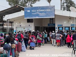
After my stay in Salta, Argentina, I head directly to Bolivia passing through the border at Yacuiba (Bolivia) and Professor Salvador Mazza (Argentina)...
—
Jun 28, 2022 — Argentina
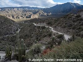
The Cuesta del Obispo is a portion of the road between Cachi and Salta with a length of about 20 kilometres. It peaks near the Piedra del Molino at an...
—
Jun 26, 2022 — Argentina
After leaving Los Cardones Park, on the way to Cachi, this mirador offers nice views on the mountains. Cachi is a pretty village in the Valles Calchaquíes...
—
Jun 24, 2022 — Argentina
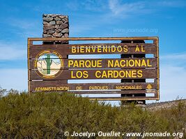
Los Cardones National Park, near the towns of Cachi and Payogasta, was created in 1996 to protect various biomes located at altitudes between 2,600 and...
—
Jun 23, 2022 — Argentina
The small village of Seclantás is within the Valles Calchaquíes along Ruta 40. Its population is only around 300 people. This road takes its name from...
—
Jun 22, 2022 — Argentina
I leave Angastaco and I continue driving on Ruta 40 in the direction of Molinos. I reach the small village of Molinos around noon. Once there, I notice...
—
Jun 21, 2022 — Argentina
Ruta 40 from Cafayate to Molinos is a real treat for the eyes. The landscapes are fantastic and every time one thinks he has seen the best, he is wrong...
—
Jun 17, 2022 — Argentina
Quebrada de las Conchas, also known under the name Quebrada de Cafayate is a magnificent canyon located in the Valles Calchaquíes near Cafayate. The...
—
Jun 16, 2022 — Argentina
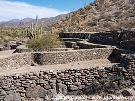
The ruins of Quilmes, also called the Sacred City of the Quilmes, is located at the foot of the Cerro Alto del Rey some 60 kilometres south of Cafayate...
—
Jun 15, 2022 — Argentina
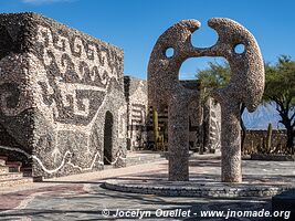
The Pachamama Museum in Amaicha del Valle is an interesting curiosity located on the way between Tafi del Valle and Cafayate. The museum offers four rooms...
—
Jun 12, 2022 — Argentina
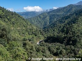
The road from San Miguel de Tucumán goes through the spectacular gorge of the Los Sosas River. It sneaks it way along the river through a dense subtropical...
—
Jun 11, 2022 — Argentina
A few kilometres after the city of Andalgalá, I drive to the mountains via the Cuesta la Chilca. The word cuesta can be translated as 'slope' 'hill'...
—
Jun 9, 2022 — Argentina
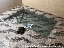
One of the attractions of the region is los Termas de Hualfín. It is a very basic place surrounded by fantastic scenery. On the site, it is possible...
—
Jun 8, 2022 — Argentina
Small trip from Villa Vil to the Laguna Blanca in the reserve of the same name. This reserve became a biosphere reserve in 1982. It protects several brackish...
—
Jun 7, 2022 — Argentina
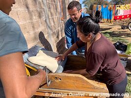
With the family where I stayed during my time in Villa Vil, I had the opportunity to learn about making bread in a traditional oven. Before the pandemic...
—
Jun 4, 2022 — Argentina
The town of Tinogasta is quite forgettable, but to the north, there are some old adobe (mud brick hardened in the sun) buildings worth a visit. The Oratorio...
—
Jun 1, 2022 — Argentina
Here are some photos of interesting sites along the way. The archeological site of Hualco dates from around DC 700 to 1000. It predates the arrival of...
—
May 31, 2022 — Argentina
From the town of Famatina, 35 km north of Chilecito, a trail leads to the Mejicana Mine (station 9). The mine's entrance is located there, at an altitude...
—
May 25, 2022 — Argentina
Talampaya is another spectacular park next to Ischigualasto Park. The main appeal of the place is the Talampaya Canyon with its vertical walls nearly...
—
May 23, 2022 — Argentina
The Ischigualasto Park, also known as Valle de la Luna (Valley of the Moon), is a UNESCO World Heritage Site since the year 2000. It contains a variety...
—
May 18, 2022 — Argentina
In Barreal, I met again my Argentinian friends Christian and Silvina. It was Silvina birthday on that beautiful autumn day, and we lunched together on...
—
May 16, 2022 — Argentina
The El Leoncito Park offers magnificent mountain landscapes in a semi desertic environment. There are a few nice treks available, and two observatories...
—
May 12, 2022 — Argentina
From Uspallata, the road to Chile leads to the Paso Internacional Los Libertadores, a mountain pass linking Argentina and Chile. The old road climbs to...
—
May 11, 2022 — Argentina
The name is quite simple and means the 'hill with seven colours.' A trail that goes to Mendoza. I drove the first half of it to enjoy the scenery. The...
—
May 10, 2022 — Argentina
The road crossing the Villavicencio private reserve is an ancient way that linked Buenos Aires to Santiago de Chile during the colonial days. The Hotel...
—
May 8, 2022 — Argentina
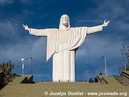
In the middle of nowhere, this huge Christo Rey appears on a hill. From the statue, the view on the plain and the Andes mountains is fantastic...
—
May 6, 2022 — Argentina
Construction of the Potrerillos Reservoir was finished in 2002 in order to provide hydroelectric power to Mendoza. It is located in the beautiful foothills...
—
May 4, 2022 — Argentina
The tiny village of Manzano Histórico, located at the foot of the Andes Mountains, protects fantastic scenery and rivers with pure water. It also has...
—
May 1, 2022 — Argentina
First travel day after the pandemic. I visit the Reserva natural y cultural Bosques Telteca, also known under the name Altos Limpios. The reserva protects...
—
Apr 20, 2022 — Argentina
Finally, it's time to travel again! After 2 years, 2 months, and 21 days, I once more set foot in South America in order to continue my trip that began...
COVID-19 pandemic... In Quebec for 2 years, 2 months and 21 days.
—
Dec 23, 2019 — Chile
During the Christmas and New Year's holiday season, I stayed in Santiago, the capital of Chile. In fact, I stayed there almost a month to relax and essentially...
—
Dec 21, 2019 — Chile
This village is one of the two access points for a visit of the Pingüino de Humboldt Reserve. From this place, it is possible to take a tour boat to...
—
Dec 19, 2019 — Chile
After my journey to the Nevado de Tres Cruces Park, I return to the coast for a few days.You will find that even though beaches in Chile are sometimes...
—
Dec 17, 2019 — Chile
The park Nevado de Tres Cruces is one of the hardest to reach in Chile due to its remoteness, and the lack of services in its surroundings.I successfully...
—
Dec 12, 2019 — Chile
Chacabuco was a mining town at the time of the saltpetre-produced nitrate boom. It once sheltered up to 5,000 people, but it is now a ghost town with...
—
Dec 11, 2019 — Chile
After a detour through Bolivia, I am back in San Pedro to visit the last popular sites around town. The town in itself is not very interesting, but the...
—
Dec 9, 2019 — Bolivia
Here we go, all good things have an end... After a superb week with Caroline, it's time to part ways. I go back to San Pedro in Chile while Caroline continues...
—
Dec 5, 2019 — Bolivia
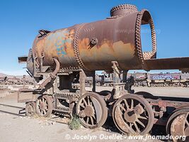
My journey with a partner ended in Uyuni, a small town right next to the salar. Next to the town, a nice train graveyard can be visited...
—
Dec 3, 2019 — Bolivia
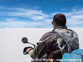
With Caroline, the second leg of our journey in Bolivia was to drive on the Salar de Uyuni, the biggest salt flat in the world. It was an awesome experience...
—
Nov 30, 2019 — Bolivia
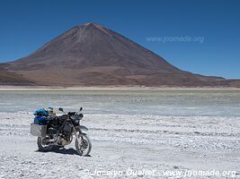
Here we are, in Bolivia, in the Eduardo Avaroa Andean Fauna National Reserve. Caroline and I just started the famous Ruta de las Lagunas. The altitude...
—
Nov 28, 2019 — Chile
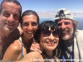
In San Pedro de Atacama, in the Chilean desert, I met Steve and Priscilla, a couple from California. They bought motorbikes in Peru and want to go down...
—
Nov 25, 2019 — Chile
In the middle of the Atacama Salt Flat, the Laguna Chaxa is one of the most visited sites near San Pedro. In the morning, numerous tourists gather to...
—
Nov 21, 2019 — Chile
The region around San Pedro de Atacama is bursting with fantastic landscapes. During about a week, I make excursions for discovering high mountains, and...
—
Nov 20, 2019 — Chile
Looking at the map, you will notice I made a big detour through the city of Calama after leaving the El Tatio Geysers. I was not in need of any supply...
—
Nov 18, 2019 — Chile
The El Tatio Geysers are a very popular attraction visited from San Pedro de Atacama. Over an area of 10 km2, one can admire numerous geysers, steaming...
—
Nov 17, 2019 — Chile
I am now heading in the backcountry and the high mountains of the Andes Mountains. I am still in the great Desert of Atacama which still offers me superb...
—
Nov 16, 2019 — Chile
La Noria is another oficina salitrera, a mining town where lives were revolving around digging for saltpetre used in nitrate plants.Nowadays, there are...
—
Nov 14, 2019 — Chile
Nowadays, Humberstone is an interesting ghost town. In its heyday, it was a lively town with a grand theatre, a large swing pool, a ballroom, a school...
—
Nov 12, 2019 — Chile
Surprise! It is a national protest day in Chile. All around the country, the main roads have been blocked for many hours.I am at the entrance of the village...
—
Nov 11, 2019 — Chile
Following the breakdown of my motorbike in the Huasco salt flat, members of the group offered me to stay a few days in their bunker. One of theirs, with...
—
Nov 7, 2019 — Chile
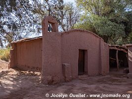
Small church lost in the middle of nowhere. There was nobody around the place. The village of Isluga is vacant during a large portion of the year. It...
—
Nov 6, 2019 — Chile
Salar de Surire Natural Monument is an enormous salt flat (with borax) located at an altitude of 4245 metres. It is almost entirely contained within the...
—
Nov 5, 2019 — Chile
I continue to drive in this reserve located directly south of the Lauca National Park. It is a region with fantastic landscapes.Curiously, I didn't see...
—
Nov 3, 2019 — Chile
Starting from Putre, I begin several days of an expedition in the high mountains of northern Chile. I will pass through several parks and salars (salt...
—
Nov 1, 2019 — Chile
From Arica, I did a few excursions in the backcountry, but without reaching the highlands. My first loop was on the route called the Missions Road, then...
—
Oct 29, 2019 — Chile
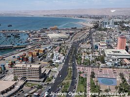
After an easy crossing at the border, my first stop is Arica. Even with a population of 233,000 inhabitants, the city is pleasant and calm. It is a very...
—
Oct 20, 2019 — Peru
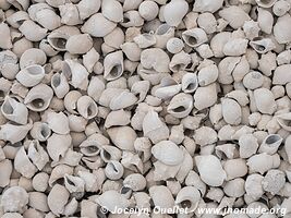
While stopping close to the ocean, I stumbled upon this peculiar fishing area. I don't know which kind of shell they are, but I think it was fairly excessive...
—
Oct 19, 2019 — Peru
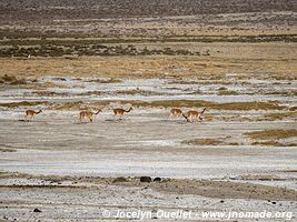
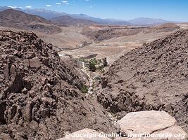
After Nazca, I make a detour towards the mountains before going back to the coast. I want to see a fairly rare species of animal; the guanaco. I visited...
—
Oct 16, 2019 — Peru
The first time I passed through the village of El Chaco, gateway to the Paracas National Reserve, I saw way too many tourists for my taste and I was completely...
—
Oct 14, 2019 — Peru
The cañon de los Perdidos is often translated as the Lost Canyon, but I prefer the name Canyon of the Lost People. Indeed, before reaching the region...
—
Oct 13, 2019 — Peru
The site of Cahuachi was an important ceremonial centre of the Nazca culture, from AD 1 to 500.The site of 1.5 km2 contains more than 40 mounds topped...
—
Oct 12, 2019 — Peru
This small museum is dedicated to Maria Reiche, an archeologist and mathematician who devoted a large part of her life to the study and conservation of...
—
Oct 6, 2019 — Peru
Tambo Colorado has been a military and urban administrative centre around AD 1140 and 1532.The complex was built with adobe bricks following the tradition...
—
Oct 2, 2019 — Peru
Huancavelica is an old mining town founded in 1571. The main resources of the region were mercury and silver. When the mine was operating, the town has...
—
Oct 1, 2019 — Peru
This itinerary of 220 kilometres was very interesting since there were so many llamas in the fields (especially near the Nor Yauyos-Cochas Reserve). At...
—
Sep 29, 2019 — Peru
Vilca, as the two other villages shown in this post, is located in the Nor Yauyos-Cochas Landscape Reserve.It is a pretty and quiet village where the...
—
Sep 27, 2019 — Peru
The Nor Yauyos-Cochas Landscape Reserve protects a mix of magnificent snowy mountains, bright blue-green lakes, canyons, and rivers.It's not a hidden...
—
Sep 26, 2019 — Peru
After more than one week in Lima, I am heading to the Central Highlands. From San Mateo, I leave the main road behind and head into the outback.It was...
—
Sep 19, 2019 — Peru
Back on the coast after a few weeks in the mountains. The archeological site of Cerro Sechín dates from 1600 BC, and was discovered in 1937.The main...
—
Sep 14, 2019 — Peru
After the canyons, I took a few days off in the town of Caraz.From my hotel room, I was seeing the Cordillera Blanca. A magnificent show just after sunset...
—
Sep 10, 2019 — Peru
In the region I am about to visit, the most famous canyon is Cañon del Pato or, in English, Canyon of the Duck. However, before reaching that canyon...
—
Sep 8, 2019 — Peru
One of my favourite activities; no history to read, no need to speak a foreign language, no schedule to follow...Just the simple pleasure of driving my...
—
Sep 6, 2019 — Peru
Around Huamachuco, three sites are worth a visit if you like ruins from ancient civilizations. Even if you don't like ruins, I recommend a quick visit...
—
Sep 5, 2019 — Peru
A nice drive in the Andean Mountains over a distance of about 150 kilometres.The altitude is around 2750 metres. Second day driving toward Huamachuco...
—
Sep 3, 2019 — Peru
The church, also known as Santuario Virgen del Rosario de Polloc, is also a very interesting excursion around Cajamarca.It is one of the nicest churches...
—
Sep 2, 2019 — Peru
Cumbemayo is an astounding example of pre-Inca engineering. This aqueduct, built more than 2000 years ago, extends over an incredible length of 9 kilometres...
—
Aug 30, 2019 — Peru
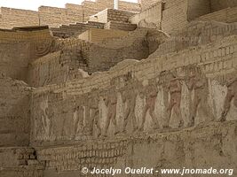
El Brujo consists of three different structures (huaca), with one that is especially impressive for its mural reliefs.The complex was mainly used from...
—
Aug 28, 2019 — Peru
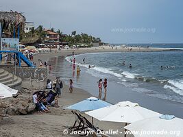
Pimentel is a nice coastal village located 12 km from Chiclayo. During the high season, its beaches are busy with numerous locals. The beach is suitable...
—
Aug 24, 2019 — Peru
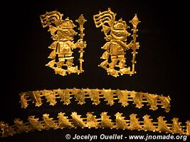
The Sicán culture thrived in the Lambayeque region from AD 750 to 1375. The Nation Museum of Sicán shows some beautiful golden artefacts from that culture...
—
Aug 22, 2019 — Peru
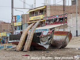
The Pacific Coast of Northern Peru is a mix of beauty and horror. There are few nice villages and small towns with nice beaches, but the majority of the...
—
Aug 20, 2019 — Ecuador
After three months in Ecuador, the country is now one of my favourite. I like everything in this small country; the mountains, the markets, the villages...
—
Aug 19, 2019 — Ecuador
It's the end of my visit in Ecuador. I am heading toward the small town of Zaruma for a night, and the next day, I will cross the border and enter Peru.Curiously...
—
Aug 16, 2019 — Ecuador
The Cajas National Park, only 30 kilometres from Cuenca, is a vast mountainous area of páramo and glacial lakes. This very wet and foggy region is considered...
—
Aug 14, 2019 — Ecuador
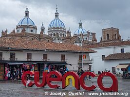
Cuenca is one of the most beautiful cities in Ecuador after Quito. The capital is more impressive, but it's not a city where I would like to live since...
—
Aug 8, 2019 — Ecuador
I am now driving towards the town of Baños.As usual, instead of going by a fast-paved road, I drove some small mountain roads in order to enjoy the scenery...
—
Aug 5, 2019 — Ecuador
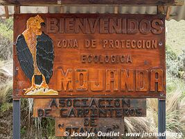
A nice excursion near Otavalo is to go to the Lagunas de Mojanda at an altitude of 3720 metres. A popular place of interest is to visit the Mitad del...
—
Aug 1, 2019 — Ecuador
Mindo is a small village known for the number of bird species in its surroundings; more than 400 have been observed. However, during the nice season...
—
Jul 11, 2019 — Ecuador
I'm still exploring the Cayambe-Coca National Park from the city of Cayambe. Yes Cayambe is a city, a park, and a volcano.This time, I went to the mountain...
—
Jul 9, 2019 — Ecuador
The park is home to Cayambe Volcano, the third-highest summit of the country with a height of 5790 metres. It's a vast territory that I explored from...
—
Jul 7, 2019 — Ecuador
I went to Laguna de Secas to see condors. On the internet, everybody says that they are easy to observe. It was the truth!On the previous photo, there...
—
Jul 5, 2019 — Ecuador
The Cotopaxi Volcano is a magnificent symmetrical cone covered by a glacier. To see this awesome summit in all its glory requires a bit of luck since...
—
Jul 2, 2019 — Ecuador
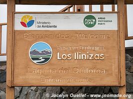
The Quilotoa is a crater lake, with a width of about 3 kilometres, that was created after the collapse of a volcano that erupted some 600 years ago. The...
—
Jun 30, 2019 — Ecuador
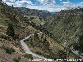
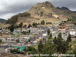
The Quilotoa loop is a circular road going around the famous Laguna Quilotoa. It's a popular itinerary with hikers since the roads and trails cross picturesque...
—
Jun 27, 2019 — Ecuador
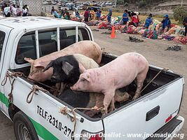
The market in Saquisilí has been one of the most impressive I've seen in Ecuador. The day starts with the animals market, on the outskirt of town, and...
—
Jun 26, 2019 — Ecuador
The small town of Pujilí is host to an interesting biweekly market. The market is located in the centre of town, on the central plaza.You will notice...
—
Jun 25, 2019 — Ecuador
Here are more photos of the magnificent mountains of Ecuador.I'm still following the Trans-Ecuador Trail, and consequently, I meet courageous cyclists...
—
Jun 23, 2019 — Ecuador
Salinas is a superb village very popular with travellers and locals alike. In addition to being picturesque, Salinas could be described as a small gastronomic...
—
Jun 21, 2019 — Ecuador
The Chimborazo volcano is the tallest mountain of Ecuador at 6263 metres. Due to the shape of Earth, the Chimborazo is both the furthest point from the...
—
Jun 16, 2019 — Ecuador
The mountains of Ecuador are magnificent, but they can hide a few surprises. A few parts of my itinerary follow the trail called Trans-Ecuador. The trail...
—
Jun 15, 2019 — Ecuador
My journey through the mountains of Ecuador is still going on. The landscapes are still spectacular. On these mountain roads, there are often road signs...
—
Jun 13, 2019 — Ecuador
Nariz del Diablo means the Devil's Nose. It's a superb region with fantastic landscapes, but also where the Trans-Andean train was crossing a steep cliff...
—
Jun 11, 2019 — Ecuador
Departing from Guayaquil on the coast, I head toward the Andean Mountains. It's the longest mountain range in the world with a length of 7100 kilometres...
—
Jun 9, 2019 — Ecuador
As I write these lines, I have been in Ecuador for almost 6 weeks. My first stop in the country has been the town of Tulcán, a pleasant mountain town...
—
Jun 8, 2019 — Ecuador
Here is the second part of my stay in Guayaquil.Park Bolivar is also nicknamed the park of iguanas because of the many reptiles that permanently lives...
—
Jun 7, 2019 — Ecuador
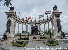
Guayaquil is the second city in importance in Ecuador after the capital Quito. However, it's the economic heart of the country with its 2.7 million inhabitants.It's...
—
Jun 3, 2019 — Ecuador
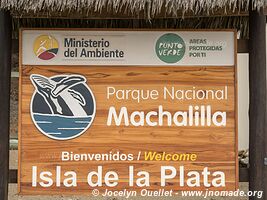
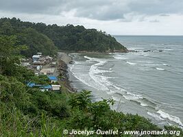
Machalilla Park is the only coastal park in Ecuador. Created in 1979, the park protects about 50 km of beaches, 400 sq km of tropical dry forest, and...
—
May 28, 2019 — Ecuador
When I was in panama, in the oppressive heat, I was dreaming of the mountains with its colder climate. But before exploring the Ecuadorian mountains...
—
May 26, 2019 — Ecuador
Some magnificent scenery on the trail from Tulcán to the Pacific Coast...
—
May 20, 2019 — Colombia
Welcome to South America!I completed the first step of my great journey of explorations through the Americas. I am on the other side of the famous Darien...
—
May 15, 2019 — Various
Maintenance:0 km (starting from Quebec, the bike has 18896 km) +8200 km +10415 km +23500 km +27317 km +33607 kmAfter a 6 months break at home...
—
May 14, 2019 — Various
Here is a list of modifications made on the bike and a few comments on them.When I refer to the TAT, it means the Trans-America Trail. This trail is...
—
May 14, 2019 — Panama
My trip to Panama started with a visit of the Bocas del Toro Archipelago where I stayed one week to explore beaches and the jungle on some of the islands...
—
May 7, 2019 — Panama
The Panama Canal cuts through the Isthmus of Panama and ends in the Atlantic Ocean in the Colón Province. Unlike the capital, the city of Colón is not...
—
May 1, 2019 — Panama
Panama City, a capital with more than 1,5 million inhabitants. Panama is the name of a city, a province, and also a country. Located on the Pacific Coast...
—
Apr 24, 2019 — Panama
Finally, it's done! I reached the end of the road... I am in Yaviza, a small remote village at the edge of the Darién Jungle.Sorry? What are you saying...
—
Apr 23, 2019 — Panama
This artificial lake was created in 1976, after the construction of a dam on the Río Bayano. Nothing better than a short stay in this small hostel located...
—
Apr 16, 2019 — Panama
The Azuero Peninsula is probably the place where the rainy and dry seasons are the most obvious. Despite the fact that the rain has started in the mountains...
—
Apr 10, 2019 — Panama
Some landscapes around Baru Volcano and the village of Boquete.Since the rainy season has already started, I chose to turn back. I will come back in...
—
Apr 7, 2019 — Panama
Bocas del Toro is a province located in the extreme northwest of the country. It's also an archipelago of magnificent islands with beautiful beaches and...
—
Apr 3, 2019 — Costa Rica
After a stay in Quebec, with my new camera and a good idea of my itinerary for next months, I flew back to Costa Rica. A fairly long trip since I had...
—
Apr 2, 2019 — Costa Rica
Cocles is the name of the village where I stayed a few days while visiting the surroundings. In the garden of the hostel, there were several interesting...
I do a 14-day round-trip to Quebec in order to buy a new camera and new lenses. I also renew my driver's licence.
—
Mar 7, 2019 — Costa Rica
I am trying to add a new element to my site. From now on, when you see this image in the list of posts, it will be about a text describing my latest adventures...
—
Feb 25, 2019 — Honduras
The region around Trujillo is very nice. There are interesting villages, some beautiful beaches, nice mountains in the background, and the town of Trujillo...
—
Feb 19, 2019 — Honduras
On the following panorama, one can see the mountains of the Pico Bonito Park over the plains near the city of La Ceiba. This vast park is a dense jungle...
—
Feb 17, 2019 — Honduras
Omoa is a small fishing village along the Caribbean Coast. On weekends, the village comes to life with locals from the neighbouring town of Puerto Cortés...
—
Feb 15, 2019 — Honduras
Superb park located on the east side of Lake Yojoa. Nothing better than a kayak excursion to enjoy the beauty of Lake Yojoa...
—
Feb 12, 2019 — Honduras
This cave has been explored up to a depth of 921 metres. However, only the first 300 metres are lit. ...
—
Feb 8, 2019 — Honduras
Erandique is the most beautiful village of the region, and possibly of the country. The village was at the earth of the Lenca rebellion waged by the indigenous...
—
Feb 7, 2019 — Honduras
The Lenca Road is located in the southwest of Honduras. It's a mountainous region with superb landscapes and numerous century-old villages. The Lenca...
—
Feb 2, 2019 — Honduras
Celaque National Park is one of the most beautiful parks of Honduras. The major part of the park is located at an altitude of 1800 metres or more. The...
—
Jan 31, 2019 — Honduras
At first glance, this animal centre is a bit depressing with its cages in such a beautiful environment. Don't be fooled by appearances. The place is a...
—
Jan 29, 2019 — Honduras
Copán Ruinas, despite its names, is a small town in southwest Honduras where are located the country's most important Mayan ruins. Curiously, the town...
—
Jan 26, 2019 — Honduras
After crossing the border between El Salvador and Honduras, I had to choose between a nice 175 km paved road with so-so scenery or a harder 100 km dirt...
—
Jan 23, 2019 — El Salvador
Here are a few landscapes from northwestern El Salvador.Despite the fact that the dry season is not even halfway through, the lack of water is already...
—
Jan 22, 2019 — El Salvador
Here are the two most spectacular places in El Salvador. The national park and the caldera are both located next to each other. The Coatepeque Caldera...
—
Jan 15, 2019 — El Salvador
Normally, I rarely visit any country's capital since they often have few charms, lots of traffic, pollution and violence. San Salvador is among the cities...
—
Jan 11, 2019 — El Salvador
Arcatao is a lovely mountain village near the border with Honduras. My old guidebook, published more than 12 years ago, mentions that this village has...
—
Jan 8, 2019 — El Salvador
Located in northeastern Salvador, Perquin had a major role during the civil war that ravaged El Salvador for 12 years, from 1980 to 1992. The war raged...
—
Jan 7, 2019 — El Salvador
Here are a few photos taken in northeastern El Salvador. The paintings in this cave are some 10,000-year-old according to some archeologists. The cave...
—
Jan 5, 2019 — El Salvador
One of my favourite places in El Salvador! The beaches along the country's Eastern Pacific Coast are amongst the nicest of all the region. I had the opportunity...
—
Jan 4, 2019 — El Salvador
A few photos of nice sites in the country. The Pacific Coast around the Bay of Jiquilisco is barren of any trace of tourism development. It seems there...
—
Dec 31, 2018 — El Salvador
Here are some landscapes from the country's Western Pacific Coast. The beaches in the region are known for their very good surfing waves. It's here that...
—
Dec 27, 2018 — El Salvador
After the Route of the Flowers, I am heading toward the city of Santa Ana, visiting a few interesting sites on the way. This scenic site has some surprises...
—
Dec 24, 2018 — El Salvador
The Route of the Flowers is very popular in El Salvador. It's a route of some 36 km linking a series of small charming mountain towns. Although its name...
—
Dec 20, 2018 — El Salvador
After passing the border, I drove toward the El Imposible National Park. Its name comes from a gorge that was very difficult to cross for farmers and...
—
Dec 14, 2018 — Guatemala
The Guatemalan Coast has a few nice attractions, and is endowed with some decent beaches for surf enthusiasts. As you already know, beaches are not my...
—
Dec 11, 2018 — Guatemala
Santiaguito Volcano is located at the foot of Santa Maria Volcano, and a few kilometres from the city of Quetzaltenango. It's still active, and sometimes...
—
Dec 7, 2018 — Guatemala
Markets in Guatemala are very colourful. In the mountains, people with Mayan ancestry still wear traditional outfits. Among the three markets I visited...
—
Dec 2, 2018 — Guatemala
Lake Atitlán is born from a massive eruption some 84,000 years ago. The quantity of magma expelled from the Earth's depth caused the surface terrain...
—
Nov 28, 2018 — Guatemala
After Pacaya Volcano, I wanted to tackle the Acatenango Volcano. Its summit towers at 3880 metres, almost 1300 metres higher than Pacaya. This time, I...
—
Nov 25, 2018 — Guatemala
Guatemala is a nice place to explore volcanoes, some of which are active. However, since I travel with a motorbike, I don't have any backpack and my equipment...
—
Nov 23, 2018 — Guatemala
When you are surrounded by volcanoes, it's a must to drive around in search of beautiful landscapes. Here are a few images of the region around Antigua...
—
Nov 19, 2018 — Guatemala
Lake Amatitlán, with the Agua Volcano in the background, is located only 25 kilometres from the capital. For such a nice lake, it's surprising to see...
—
Nov 18, 2018 — Guatemala
Located at the top of Ipala Volcano, this small crater lake is about 1 kilometre long, and is at an altitude of 1493 metres.I spent a night camping on...
—
Nov 16, 2018 — Guatemala
Lake Izabal is the largest one in Guatemala, and it's the source of Rió Dulce. There are several nice sites to visit all around the lake. Here are a...
—
Nov 15, 2018 — Guatemala
During the boat tour, I stopped at this hotel on the Tatin River, a tributary of the Rió Dulce. I slept in one of these dormitories that has spaces for...
—
Nov 11, 2018 — Guatemala
Alta Verpapaz et Baja Verapax are two mountainous departments in the centre of the country. This region is populated by the Rabinal Maya, a group known...
—
Nov 6, 2018 — Guatemala
Santa Maria de Nebaj is a municipality in the Quiché region. The region is also known as the Ixil Triangle for its people. Personally, I don't think...
—
Nov 4, 2018 — Guatemala
San Mateo is a mountain village with mainly Mayan population. The women of the area wear very colourful huipiles. The landscapes around the village are...
—
Nov 3, 2018 — Guatemala
Did I ever tell you that I love riding a motorbike? Yes, it's tiring, the rain and cold can be a major deterrent, and it's not possible to sleep anywhere...
—
Nov 2, 2018 — Guatemala
The Day of the Dead is normally celebrated on November 1st, but in Todos Santos, the day is postponed to November 2nd to allow for the horse race.The...
—
Nov 1, 2018 — Guatemala
The most famous events of the Todos Santos fiesta is the horse race. During the days preceding the race, the competitors celebrate, dance, and drink a...
—
Oct 30, 2018 — Guatemala
Todos Santos is usually a small quiet town where inhabitants proudly wear brightly coloured traditional clothing. In many regions, only women wear traditional...
—
Oct 28, 2018 — Guatemala
After more than 6 months in Quebec, I am back in Mexico to retrieve the motorbike that was in storage in Tapachula. I had left it outside, under a blue...
I take a break for a few months in Quebec... From Quetzaltenango, I drive to Tapachula in Mexico to store the motorbike. The city is about 20 kilometres from the Mexico-Guatemala border, and it is a 'Free Zone.' This means, I don't have to register the motorbike with a temporary import permit. After my break in Quebec, I drive back to Guatemala where I will continue my trip.
—
Mar 26, 2018 — Guatemala
It's the end of the first stage of my trip. After a few days in this city, I will return to Quebec for a few months. My mother is selling her house and...
—
Mar 22, 2018 — Guatemala
The site is a series of pools with turquoise to green-emerald coloured water. It is easy to spend a full day swimming in each of the pools. ...
—
Mar 19, 2018 — Guatemala
Naj Tunich was a pleasure to discover due to its remoteness. Indeed, I had very few information on its location, and I had to rely on an imprecise map...
—
Mar 19, 2018 — Guatemala
A superb cave near the village of Lanquín. The cave extends for several kilometres, but only the first hundreds metres are easily accessible. ...
—
Mar 17, 2018 — Guatemala
Sayaxché is a very ordinary small dusty town. However, the road to get there comes up against the River of Passion (Río de la Pasión). There is a ferry...
—
Mar 15, 2018 — Guatemala
After the jungle, a few days of rest around lake Petén Itzá were very welcome. Many people choose to stay on the island of Flores, but I chose to base...
—
Mar 7, 2018 — Belize
This reserve is a superb mountainous area with awesome forests, rivers, and waterfalls. The rivers and falls are great places to swim.....
—
Mar 4, 2018 — Belize
Mennonites are also present in Belize. There are many communities, and most of them are relative to those that came from Canada. An underground river...
—
Feb 28, 2018 — Belize
This sanctuary has the reputation to be an excellent place for birds observation. As far as I am concerned, it was not a great success. Indeed, February...
—
Feb 25, 2018 — Belize
Lamanai was occupied as early as 1500 BC, and it was a very important ceremonial centre. Its peak seems to have been from 200 to 100 BC, and its main...
—
Feb 19, 2018 — Mexico
Here is a fantastic show from Mother Nature. Looking at this small hole at the bottom of the hole, it's easy to think it's boring. Indeed it is. However...
—
Feb 17, 2018 — Mexico
Here are some interesting archeological sites in the Yucatán Peninsula. They are less-visited sites and for some of them, the highlight is the road to...
—
Feb 9, 2018 — Mexico
Chichén Itzá is a UNESCO World Heritage Site. It is surrounded by at least five cenotes that are an important source of water in this arid region. For...
—
Feb 7, 2018 — Mexico
Cenotes are natural pit, or sinkhole, in a specific type of rock. They are mostly found in North and Central America, more specifically in the Yucatán...
—
Feb 2, 2018 — Mexico
In 1517, when the Spanish arrived, Campeche was only a small Mayan village named Ah Kim Pech. The Mayas of the area were very hostile toward the Spanish...
—
Jan 26, 2018 — Mexico
This superb region is a mix of lakes, ruins, and forest. There are dozens of lakes to see and some old Mayan ruins. A lake at the border of Guatemala...
—
Jan 23, 2018 — Mexico
The nice colonial town of Comitán is very nice, especially its central park. Small Mayan ruins near Comitán. This site may have been in use up to AD...
—
Jan 20, 2018 — Mexico
The region around San Cristóbal is dotted with superb villages and fantastic landscapes. One of the villages, San Juan Chamula, is very independent...
—
Jan 18, 2018 — Mexico
San Cristóbal is a splendid town known for its colonial architecture. Around the town, there are numerous traditional villages with ancient beliefs and...
—
Jan 16, 2018 — Mexico
The town of Chiapa de Corzo was one of these places where you stop at random and where you end up staying much longer than initially anticipated. At first...
—
Jan 11, 2018 — Mexico
In the beginning, I thought my stay at the Escobilla Turtle Centre would be short. I witnessed to the release of baby turtles with other tourists, and...
—
Jan 2, 2018 — Mexico
What a lovely place to spend a few days during New Year's Eve. While my Canadian/Quebec compatriots are freezing in temperatures around -30 degrees Celsius...
—
Dec 23, 2017 — Mexico
Oaxaca is a pretty city in the mountains known for its culture and food.Surrounded by villages, markets, hiking trails, and interesting archeological...
—
Dec 22, 2017 — Mexico
Monte Albán is one of the most important archeological sites of Mexico. It competes with other great sites such as Teotihuacán, Palenque, or Chichén...
—
Dec 21, 2017 — Mexico
The ruins of Mitla are located in the centre of the modern village of San Pablo Villa de Mitla. The ruins date from a few centuries before the Spanish...
—
Dec 20, 2017 — Mexico
Located at an altitude of 1,800 metres, this site is a splendid bubbling mineral springs. A natural infinity pool was created next to a cliff, offering...
—
Dec 18, 2017 — Mexico
Tlacotalpan is a UNESCO World Heritage site. It's a colonial town from the 19th century, well preserved and renovated. The colour palette of...
—
Dec 7, 2017 — Mexico
Yes, a park's name quite difficult to pronounce, but with incredible scenery. Iztaccíhuatl is a dormant volcano while Popocatépetl is active and its...
—
Dec 2, 2017 — Mexico
Taxco became rich from numerous silver deposits exploited during nearly 400 years and still harbour a rich colonial heritage. Nowadays, these deposits...
—
Dec 1, 2017 — Mexico
The monarch's sanctuary hasn't been a great success. I visited the sanctuary during the butterfly high season, but by some misfortunes, I didn't see as...
—
Nov 28, 2017 — Mexico
How do I feel about a city of more than 22 million inhabitants? Some suburbs are very nice, but the population density and especially the traffic jams...
—
Nov 26, 2017 — Mexico
The National Museum of Anthropology showcases an impressive art collection on Mexican cultures from prehistory to modern times. The most interesting sections...
—
Nov 24, 2017 — Mexico
The pyramids of Teotihuacan are among the most famous and most visited of Mexico. The site is located 50 km north-east of Mexico City and is a UNESCO...
—
Nov 21, 2017 — Mexico
Las Pozas is the creation of the British poet Edward James. It's a garden with surrealistic structures built between 1962 and 1984 in a subtropical forest...
—
Nov 17, 2017 — Mexico
The road to the town is 24 km path made of cobblestones. Imagine all the work to do it.It's a nice road, but it is a bit bumpy. Fortunately with a motorbike...
—
Nov 14, 2017 — Mexico
In the previous post, I told you about the fascination Mexicans have with death. Here is another example of it, a museum entirely dedicated to the death.In...
—
Nov 12, 2017 — Mexico
WARNING: If you don't like what you see at the beginning of this post, don't go any further. There are mummies of babies and very young children below...
—
Nov 11, 2017 — Mexico
Ah Guanajuato, what a fantastic place! It is a very photogenic city, and you will quickly understand why it is a UNESCO World Heritage site.The city of...
—
Nov 9, 2017 — Mexico
San Miguel de Allende is a beautiful city with a colonial architecture, cobblestone streets, and superb lighting of certain buildings at nights. In 2008...
—
Nov 6, 2017 — Mexico
Volcano Paricutín is still quite young at 80 years old and with a height of 2800 metres. On February 20, 1943, while a farmer was labouring its field...
—
Nov 4, 2017 — Mexico
Highway 200, also known as Carretera Pacífico in Spanish, follow the Pacific Coast for about 2000 km and crosses seven Mexican states. Here are a few...
—
Oct 31, 2017 — Mexico
Guadalajara is the second-biggest city of Mexico with 1.5 million people; 4 million when counting the greater metro area.The city has a superb downtown...
—
Oct 29, 2017 — Mexico
I am not a fan of beaches, but here I am in a very touristy seaside town resort. To my great surprise, I loved this town. The beaches are nice, the waterfront...
—
Oct 25, 2017 — Mexico
Who is Francisco Villa, nicknamed Pancho Villa? He is one of the most famous historical figures of the Mexican Revolution in the years 1910 to 1920.I...
—
Oct 23, 2017 — Mexico
At the beginning of this journey, during our crossing of the United States on the Trans-America Trail, Alvaro, Thierry and I have met a Mennonite community...
—
Oct 20, 2017 — Mexico
In the last part, I present you the classic Copper Canyon. It is the touristy part where most people go. The train starting from Los Mochis and reaching...
—
Oct 18, 2017 — Mexico
Up to now, the trail from Urique to Batopilas, has been the most difficult one that I drove in solo. Before starting the trail, I knew that the first...
—
Oct 17, 2017 — Mexico
The landscapes in the first part were fantastic, but those I was about to see after Cerocahui were even more impressive. A few kilometres after Cerocahui...
—
Oct 14, 2017 — Mexico
The Copper Canyon (Barrancas del Cobre, in Spanish) is a series of canyons located in the southwestern part of the state of Chihuahua. Six canyons and...
—
Oct 11, 2017 — Mexico
The Pueblos Mágicos are villages or towns that offer a 'magical' experience with their beauty, culture, or history. Álamos is the first magical site...
—
Oct 6, 2017 — Mexico
I entered Mexico by the border post at Tecate. On the American side, there is no real village, but on the Mexican side, there is a bustling town.Crossing...
—
Oct 2, 2017 — United States
My journey continues toward the south through the mountains. The scenery is fantastic. Here are some landscapes of the last week in the United States...
—
Sep 28, 2017 — United States
Reno is a mini Las Vegas. I say 'mini' since Reno is far from being an equal to Las Vegas. It is far less impressive, and there are fewer illuminated...
—
Sep 24, 2017 — United States
We reached the Pacific Coast in Oregon, but we didn't complete the last kilometres on the Trans-America Trail. Because of a tight schedule and also since...
—
Sep 9, 2017 — United States
After many adventures, we are finally in Oregon, on the Pacific Coast.It is the end of our journey on the Trans-America Trail. Thierry and Alvaro are...
—
Sep 8, 2017 — United States
Our journey continues in Utah, one of the most scenic areas of the TAT. In turn, some sections of the route are very difficult especially when carrying...
—
Sep 7, 2017 — United States
The United States is the best country for guns. Many Americans claim high and loud their right to have a firearm. Indeed, in the American Constitution...
—
Sep 3, 2017 — United States
Who are the Mennonites? Do you remember the movie Witness (1985) with Harrison Ford? That film is about Amish, but Mennonites live in a similar way.For...
—
Sep 1, 2017 — United States
Here we are at the start of the Trans-America Trail, clean, shaved, and with bikes and luggage in good conditions. The TAT crosses the United States from...
—
Aug 1, 2017 — Quebec
Motorbiking is a new adventure for me and it's the first time I drive. I hope I am going to like it and be able to accomplish the whole journey. Even...
—
Jan 14, 2016 — Tanzania
Here is my last post for this trip. The trip is completed and I sold the vehicle, the fridge, and all the stuff I cumulated for a number of years.I take...
—
Oct 20, 2015 — Kenya
I really wanted to visit this park before leaving Africa. The park is famous and you probably already saw a picture of it. Indeed, the iconic photo of...
—
Oct 17, 2015 — Tanzania
This park is the smallest of Tanzania with only 52 km2. However, it is an important one since it shelters a small population of chimpanzees.It...
—
Oct 13, 2015 — Tanzania
I wasn't sure about visiting this park since tsetse flies have a reputation for being nasty. In the end, I spent a whole day there. Wow, it is a very...
—
Oct 11, 2015 — Tanzania
Lake Tanganyika is the second-biggest freshwater lake in the world (in volume). It is also the second deepest in the world.The lake extends for 676 km...
—
Oct 6, 2015 — Malawi
Chongoni, near the town of Dedza, is a UNESCO World Heritage site. The area shelters 127 rock art sites dating from at least 2,000 years. Of these 127...
—
Oct 1, 2015 — Malawi
The Mulanje Massif is a huge granite inselberg rising by an average of 2,000 metres above the plains. The characteristic of the massif is its isolation...
—
Sep 30, 2015 — Malawi
This reserve is a peculiar place. Several species have been reintroduced after going extinct due to poaching. Species (such as the nyala) never existed...
—
Sep 29, 2015 — Malawi
Lengwe is a small park that greatly suffered from poaching in the past. Nowadays, several animals are still victims of snares installed by farmers and...
—
Sep 28, 2015 — Malawi
For the last few years, the value of the kwacha has been going down on the financial markets. In 2010, $US 1 was worth about 150 kwachas. In September...
—
Sep 26, 2015 — Malawi
The Zomba Plateau is a small rocky mountain of about 130 km2. Altitudes can reach up to 2,087 metres with cliffs of 1,200 metres. Unfortunately...
—
Sep 24, 2015 — Malawi
It is in this park where animals are the easier to observe in Malawi. I was surprised to observe around a hundred elephants.Of all the game parks and...
—
Sep 20, 2015 — Malawi
The Mua Mission is a fascinating site for three reasons. The mission by itself has a superb church and a hospital. In addition, the KuNgoni Art Centre...
—
Sep 12, 2015 — Malawi
This large park, located at an average altitude of 2000 metres, is known for its mountains scenery. It is also possible to see several species of antelopes.It...
—
Sep 11, 2015 — Malawi
The Vwaza Reserve protects the Vwaza Swamp and Lake Kazuni. Since the reserve is infested with tsetse flies, I stayed near Lake Kazuni at the entrance...
—
Sep 8, 2015 — Malawi
Livingstonia is perched at 700 metres above Lake Malawi. The road to get there is a series of hairpin bends so tight that the last of them is only 4 km...
—
Sep 6, 2015 — Tanzania
Here are miscellaneous photos. A restaurant with a baobab in the middle...
—
Sep 2, 2015 — Tanzania
Around midday, I went to a picnic site to have a lunch. I wasn't paying attention to what was going on around me.As soon as I opened the door to get out...
—
Sep 1, 2015 — Tanzania
The Selous is the largest reserve of Africa with 54,600 km2. The reserve was once famous for its large herds of elephants. Unfortunately...
—
Aug 28, 2015 — Tanzania
East Africa was known by the Greeks since 400 BC. Important trading posts had been established in the region. In the early part of the first millennium...
—
Aug 27, 2015 — Mozambique
To get to the border of Tanzania, the Ruvuma River must be crossed. It is possible to do so by using the Unity Bridge, which entails a detour of 700 km...
—
Aug 21, 2015 — Mozambique
The Quirimbas National Park is a group of 32 islands. The easiest one to visit is called Ibo Island. It's the only island with infrastructure for low-budget...
—
Aug 20, 2015 — Mozambique
In Mozambique, there are many kilometres on flat land with few interesting scenery. From time to time, there are little rocky hills sprouting from the...
—
Aug 17, 2015 — Mozambique
The Niassa Reserve is located in northern Mozambique. It is a vast territory split in a dozen concessions; some are for hunting, others for research...
—
Aug 14, 2015 — Mozambique
Lake Niassa, also called Lake Malawi, is very well known to travellers on the Malawian side. However, the section of the lake located in Mozambique is...
—
Aug 11, 2015 — Mozambique
The Mossuril Bay is located on the continent in front of Mozambique Island. It also has some relics from the Arabs and Portuguese era. Church built in...
—
Aug 8, 2015 — Mozambique
Mozambique Island is a World heritage site as selected by UNESCO. It's a small island with 3 km in length and 500 metres in width. This island has a history...
—
Jul 29, 2015 — Mozambique
I wanted to sleep on the side of the road like I did so many times, but local people were afraid that I was a thief… Around twenty people, with a police...
—
Jul 28, 2015 — Mozambique
After spending a night at this luxury hotel, I was telling people that I spent a night in a 5-star lodge directly on the ocean... and all this was free.Here...
—
Jul 25, 2015 — Mozambique
The Bazaruto Archipelago is a group of paradisiacal islands with white sand and superb clear and turquoise water. These islands are part of a protected...
—
Jul 14, 2015 — Mozambique
I did several dives in Tofo and I decided to rent a camera and try underwater photography. The visibility wasn't very good for photos and the equipment...
—
Jul 10, 2015 — Mozambique
Ah, here is the famous village of Tofo, known to backpackers for its vibe, beaches, parties, and scuba diving. In season, it is possible to see humpback...
—
Jul 6, 2015 — Mozambique
Ponta do Ouro is located at the southernmost point of Mozambique. I was told to go there mainly for excellent diving. It is a nice area with pretty beaches...
—
Jun 30, 2015 — Swaziland
Here is a weird park. It is not very big and is surrounded by a fence. Inside, it seems as if there are three sections each separated by a fence. In one...
—
Jun 27, 2015 — Swaziland
This tiny reserve is a good place to experience the Swazi culture. Indeed, the cultural village is far more interesting than the nature itself.The village...
—
Jun 24, 2015 — Swaziland
The Kingdom of Swaziland is one of the smallest countries of Africa and is ruled by King Mswati III. The latter is one of three remaining monarchs...
—
Jun 16, 2015 — South Africa
Kruger Park is one of the most famous game parks of Africa like other parks such as Serengeti. Before my very first journeys in Africa, I dreamt of exploring...
—
Jun 13, 2015 — South Africa
The Drakensberg Escarpment marks the point where the highveld plunges down over 1000 metres to the lowveld. It is a very picturesque area with a myriad...
—
Jun 12, 2015 — South Africa
Pilgrim's Rest is a small village established when gold was discovered in 1873. For 10 years, diggers worked on small-scale alluvial claims. In the 1880s...
—
Jun 6, 2015 — South Africa
All right, more animals again! Yes, but what a show!Since I had been successful in the last park, I installed myself in a hide and I waited all day for...
—
Jun 3, 2015 — South Africa
This long coastline of 280 kilometres stretches from the border with Mozambique, near Kosi Bay, to the town of St Lucia. All this area is nicknamed the...
—
Jun 1, 2015 — South Africa
Despite the number of parks and animals I have seen in the past months, the Hluhluwe-Imfolozi Park was an impressive experience. As in any parks, it is...
—
May 28, 2015 — South Africa
The Wild Coast stretches for nearly 350 kilometres from East London to Port St Johns. Contrary to many other places in South Africa, this area is not...
—
May 23, 2015 — South Africa
This reserve protects a 4 km peninsula with a rugged coastline of cliffs and rocks.There is a superb trek on a circular trail around the peninsula. Landscapes...
—
May 20, 2015 — South Africa
This town is nicknamed the 'Jewel of Karoo'. It is the fourth oldest colonial town of South Africa and has a nice architectural heritage. This house is...
—
May 18, 2015 — South Africa
The Karoo region is a vast plateau with a semi-arid climate. This ecosystem covers about one third of the area of South Africa. There are some nice parks...
—
May 8, 2015 — South Africa
In this park, I did a superb hike of 5 days and 4 nights with Anik, whom I have been travelling with for the past few days. Normally, the hike is limited...
—
May 7, 2015 — South Africa
In a park that has the word elephant in its title, one would expect to see many of them, but it's not necessarily the case. In guidebooks, it is mentioned...
—
May 4, 2015 — South Africa
Bulungula is a small and remote village on the Wild Coast accessible by a bumpy gravel road that is annoying to drive. Once at the destination, we were...
—
Apr 25, 2015 — Lesotho
A huge hydroelectric project is currently going on in Lesotho. It has started some 10-15 years ago and should go on for another 10 years. The project...
—
Apr 22, 2015 — Lesotho
It is the only park I have visited in Lesotho. There, I have done a nice trek of about 15 km through nice scenery. Lesotho's climate is quite unpredictable;...
—
Apr 21, 2015 — Lesotho
Most of the time, people travel from point A to point B to visit the nicest sites of a country. The road is sometimes boring, but sometimes it can be...
—
Apr 15, 2015 — South Africa
The Sani Pass is a link between the province of KwaZulu-Natal in South Africa and the Kingdom of Lesotho. It's a spectacular ride around hairpin bends...
—
Apr 12, 2015 — South Africa
The Drakensberg forms the border between South Africa and the mountain kingdom of Lesotho. This vast region got the World Heritage status in 2000. At...
—
Apr 10, 2015 — South Africa
The Golden Gate Highlands National Park is a small park protecting part of the Maloti Mountains. It is located north of the Drakensberg Mountains near...
—
Apr 6, 2015 — South Africa
Kimberley was a very important mining town at the end of the 1800. In the ancient volcano, named the Big Hole, diamonds were discovered.Nowadays, the...
—
Apr 3, 2015 — South Africa
After a few days in town visiting museums, nothing is better than a going back in an African park. It is still a lot of fun and it allowed me to test...
—
Mar 28, 2015 — South Africa
Johannesburg has the reputation of a dangerous city where crimes are very frequent. As Nairobi in Kenya, the list of crimes is impressive: home thefts...
From Livingstone in Zambia, I head toward Lusaka, and then I drive through Zimbabwe in two days. Finally, I drive to Johannesburg in South Africa where I store the vehicle. I take a break for 6 months in Quebec.
—
Nov 1, 2014 — Quebec
I am back home... After 13 months living in my small van and driving in African territory, I was in need of some vacations. You are going to tell me that...
—
Sep 14, 2014 — Zambia
When I came back to Livingstone near the Victoria Falls, I decided to see the waterfalls in the dry season. I wanted to see the difference with the rainy...
—
Sep 4, 2014 — Zimbabwe
I am back to the Victoria Falls after 6 months of travel. In February, I have visited the falls on the Zambian side. This time, I am on the Zimbabwean...
—
Aug 30, 2014 — Zimbabwe
Hwange National Park is the largest park in Zimbabwe. It is known for the large quantity of animals it protects and by the considerable density of elephants...
—
Aug 24, 2014 — Zimbabwe
Lake Kariba is the biggest artificial lake (in volume) in the world. It was created after the Kariba dam was built between 1955 and 1959 on the Zambezi...
—
Aug 19, 2014 — Zimbabwe
This park is named Mana Pools because of its four waterholes; Mana means four in the local language. However, it is not the four pools that are the most...
—
Aug 10, 2014 — Zimbabwe
Nyanga Park is famous for its mountainous scenery, its rivers and waterfalls. It boasts the highest mountain of Zimbabwe; Mount Nyangani at 2592 metres...
—
Aug 6, 2014 — Zimbabwe
The Chimanimani Park is a small paradise for hiking. I spent a few days visiting several locations of the park such as waterfalls. It is also possible...
—
Aug 4, 2014 — Zimbabwe
This small luxuriant forest is quite a surprise in an African country. It is a rain forest located at an altitude of about 1500 metres. The forest is...
—
Aug 1, 2014 — Zimbabwe
The Gonarezhou National Park is part of the Great Limpopo Transfrontier Park. This park covers three countries; Zimbabwe, Mozambique, and South Africa...
—
Jul 27, 2014 — Zimbabwe
Zimbabwe is a country that often gets depicted negatively. A country that suffered from civil war, a country with parks devastated by poaching, a country...
—
Jul 21, 2014 — Zimbabwe
The Matobo National Park is a UNESCO World Heritage site. It consists in two areas; one is a game park and the other is a recreational park. In most parks...
—
Jul 15, 2014 — Various
Ha! The joy of having a vehicle on the African continent; great outdoor spaces, 4x4 trails, African animals and the freedom to go where one wants. However...
—
Jul 9, 2014 — Botswana
The Khama Rhino Sanctuary protects about forty white rhinos and a few black rhinos. Often, in such places, it is quite difficult to see rhinoceros unless...
—
Jul 5, 2014 — Botswana
Nwetwe is part of the Makgadikgadi Pan that is made of many salt pans such as Nwetwe, Sua and Nxai. This network of salt pans was once covered by Lake...
—
Jul 4, 2014 — Botswana
Sometimes, we discover a nice place where service is excellent and the place itself is very appealing. In Africa, it is sometimes difficult to get good...
—
Jun 29, 2014 — Botswana
The Tsodilo Hills are located north-west of Botswana. If you follow my trip on the Google map, you will notice that I made a detour through Namibia. In...
—
Jun 24, 2014 — Various
At some point, I had the weird idea of taking photos of road signs that I thought were interesting. The idea took form in Ethiopia because of signs drawn...
—
Jun 19, 2014 — Botswana
In the previous post, I was writing about the reasons that keep me doing more game drives. Here is one; these lions have killed this big buffalo and have...
—
Jun 17, 2014 — Botswana
I am now along the Chobe River parts of the Chobe National Park.Yes, I am still visiting a park and presenting you with photos of animals. I don't know...
—
Jun 15, 2014 — Botswana
The Chobe Park is divided in three main zones known as the Chobe Riverfront, the Linyanti Marshes, and Savuti. I visited two of these regions and I now...
—
Jun 12, 2014 — Botswana
Botswana is a fascinating country with most of it almost entirely made of two ecosystems. On one side, there is the Kalahari Desert with its sand, yellow...
—
Jun 9, 2014 — Botswana
The Makgadikgadi Park is a desert area part of the great Kalahari Desert. It is a huge land of several dozens of kilometres. The main interest in this...
—
Jun 1, 2014 — Botswana
As stated in the previous post, the Kalahari Desert covers about three quarters of Botswana and there is sand everywhere; it is the largest contiguous...
—
May 25, 2014 — South Africa
Kgalagadi Park is a wild land covered with white or red sand where thorn trees survive under a scorching sun. It is part of the Kalahari Desert that covers...
—
May 21, 2014 — South Africa
Augrabies Falls are created by the Orange River flowing through 18 km long canyon with cliffs reaching 200 metres high. The canyon is the main attraction...
—
May 10, 2014 — South Africa
The World of Birds is a centre that shelters many species of exotic animals that have been confiscated because they were kept illegally or just badly...
—
Apr 29, 2014 — South Africa
At Stony Point, near the village of Betty's Bay, a huge colony of African Penguins can be observed. They can be seen strolling around, swimming, fighting...
—
Apr 18, 2014 — South Africa
We are continuing our exploration of new places in South Africa.Here, we are at Cape Agulhas. This site is the most southern point of the whole Africa...
—
Apr 13, 2014 — South Africa
We are now in South Africa after more than 7 months on the road. Many people say that the country is not Africa anymore, but the Western World. I partly...
—
Apr 11, 2014 — Namibia
This magnificent canyon measures 160 km in length, and up to 27 km in width, and reaches a depth of 550 metres. Seeing it, one can think of the Grand...
—
Apr 8, 2014 — Namibia
Kolmanskuppe is an old diamond mining town. The town once had a casino, a bowling alley and a theatre. However, the town was abandoned after the First...
—
Apr 6, 2014 — Namibia
In certain respects, Luderitz is somewhat similar to Swakopmund. The German influence is everywhere in the architecture of the houses and churches. There...
—
Mar 26, 2014 — Namibia
Sossusvlei is a salt pan ('vlei' in Afrikaans) located in the Namib Desert. It is a small salt lake dry most of the year. It is surrounded by dunes reaching...
—
Mar 22, 2014 — Namibia
Windhoek is a nice capital with about 350,000 inhabitants. Nevertheless, there are few things to do in this city except the good restaurants and the numerous...
—
Mar 19, 2014 — Namibia
This mountain of 1,728 metres is very scenic and apparently resembles the Matterhorn in Switzerland. It is a very nice region where to walk around. There...
—
Mar 16, 2014 — Namibia
The Namib-Naukluft Park encompasses the Namib Desert and also the Naukluft Mountains. Both environments are very different and magnificent. The part of...
—
Mar 14, 2014 — Namibia
Namibia was once a German colony. Therefore, the city architecture has a strong German influence. For us, it is the nicest town that we had the chance...
—
Mar 13, 2014 — Namibia
The Cape Cross Reserve shelters around 100,000 seals coming here to reproduce each year. This area is very rich in fishes due to the Benguela current.It...
—
Mar 11, 2014 — Namibia
The Dorob National Park exists only since 2010 and consumes the old 'West Coast Tourist Recreation Area'. The park protects a desert zone where lichens...
—
Mar 10, 2014 — Namibia
The Brandberg Mountains are famous for its numerous rock paintings. As for the rock engravings at Twyfelfontein, these paintings could have been done...
—
Mar 9, 2014 — Namibia
Twyfelfontein means 'Doubtful Fountain'. During colonial time, the farmer who named this water source was not sure if the fountain would flow permanently...
—
Mar 8, 2014 — Namibia
We are in a desert zone and we went to see a forest. Weird, isn't it?In fact, it is about an area where ancient trees now transformed in rock are scattered...
—
Mar 6, 2014 — Namibia
Damaraland is another region of Namibia with a semi-desert climate. The landscapes are magnificent and there are nevertheless some animals well adapted...
—
Mar 3, 2014 — Namibia
Here is the second post on the Kaokoveld. You can see the first part by clicking the following link: part 1. Epupa Falls are located on the Kunene River...
—
Mar 1, 2014 — Namibia
The Kaokoveld is a huge region in northwestern Namibia. The region is sparsely populated, and few roads are accessible with a small car. There are a lot...
—
Feb 22, 2014 — Namibia
The Waterberg Plateau is a curious rock formation in the middle of a pain. It is a sandstone plateau 50 km long by 16 km large. The plateau is divided...
—
Feb 18, 2014 — Namibia
We spent 3 days in Etosha Park. All books say that it is better to visit in the dry season to spot the animals easily. Despite the fact we were in the...
—
Feb 15, 2014 — Namibia
Here, I show some interesting sites that we have visited crossing the northern part of the country. In 1920, this meteorite has been found on a farm land...
—
Feb 9, 2014 — Namibia
Bwabwata Park is located in the far north-east of Namibia in a small region called the Caprivi Strip. It is a narrow strip of about 450 km located between...
—
Feb 6, 2014 — Zambia
This park near the town of Livingstone and the Victoria Falls is tiny. However, it shelters a varied and impressive fauna.This park was the first safari...
—
Feb 5, 2014 — Zambia
Victoria Falls are very impressive even though they are quite difficult to photograph. Depending on the season, the volume of water can be 10 times bigger...
—
Feb 3, 2014 — Zambia
We left Ethiopia on January 10th and here is a post on Zambia. There is a gap of nearly 20 days between these two countries; what happened?After Ethiopia...
—
Jan 4, 2014 — Ethiopia
Of all the tribe of Ethiopia, the Mursis are possibly the most fascinating. They are famous for the lip plate that women wear on the lower lip. Surprisingly...
—
Dec 25, 2013 — Ethiopia
The fauna in the Bale Mountains is exceptional, I am showing the species that I managed to photograph... There are several more species...
—
Dec 24, 2013 — Ethiopia
We spent Christmas time in the Bale Mountains in the end. The park has been a great surprise since the landscapes are wonderful, the fauna is interesting...
—
Dec 16, 2013 — Djibouti
Lake Assal is the most impressive place in Djibouti. It is a extremely salted lake located 153 metres below sea level. In fact, it is the lowest place...
—
Dec 15, 2013 — Djibouti
Djibouti is a desert and volcanic country with a very arid climate and temperatures near 35 degrees Celsius during the day... sometimes even up to 40...
—
Dec 13, 2013 — Djibouti
When we looked at an African map to plan our trip in Ethiopia, we noticed this small and barely visible country. We knew about this country only the name...
—
Dec 10, 2013 — Ethiopia
The Dakhata Valley is nicknamed the Valley of Wonders due to some peculiar rock formations offering nice scenery.This valley of about 12 km is on the...
—
Dec 9, 2013 — Ethiopia
Yes, it is really a wild hyena. These animals have a bad reputation mainly because of the movies depicting them as evil beasts. Personally, I think that...
—
Dec 8, 2013 — Ethiopia
The city is located at the foot of the Ahmar Mountains, and to the north is the huge Danakil desert. At an altitude of 1856 metres, Harar has a different...
—
Dec 5, 2013 — Ethiopia
On the ground of the Addis Ababa University, there is an ethnological museum. In this magnificent building, once the palace of Emperor Haile Selassie...
—
Nov 30, 2013 — Ethiopia
The Tigray is a large region northeast of the country. It is a semi-arid zone known for its magnificent churches and spectacular landscapes. In this area...
—
Nov 26, 2013 — Ethiopia
The Erta Ale volcano is the most active volcano of Ethiopia. This volcano has a lava lake (sometimes two) that is active since at least 1906. Volcanoes...
—
Nov 25, 2013 — Ethiopia
This strange and visually stunning area is made of various minerals such as sulfur and salt.Enjoy the superb photos of this place. Yes, it looks like...
—
Nov 24, 2013 — Ethiopia
The Danakil depression in northeastern Ethiopia is a fantastic region. This zone results from the convergence of three tectonic plates that created astonishing...
—
Nov 16, 2013 — Ethiopia
Ethiopians are in general very nice, but when they are behind the wheel, they are sometimes a bit stupid. The road is blocked by a bulldozer that must...
—
Nov 10, 2013 — Ethiopia
The Simien Mountains have been described by Homer (the Greek poet) as the playground where the Greek gods came to play chess. A very nice way to say that...
—
Nov 7, 2013 — Ethiopia
The royal enclosure would have started when King Fasilidas decided to permanently base himself in Gonder in the 17th century. From that moment, the royal...
—
Nov 6, 2013 — Ethiopia
Ethiopia is really a fascinating country. The landscapes are fantastic and the realms that once flourished in the region are surprising. After Lalibela...
—
Nov 3, 2013 — Ethiopia
Lalibela is famous for its rock-hewn churches, but it is also a very interesting place by itself. The market is one of the nicest we have seen and attracts...
—
Oct 31, 2013 — Ethiopia
Lalibela is a small town at an altitude of 2630 metres where twelve monumental churches have been hewn in volcanic rock. Classed by UNESCO as a World...
—
Oct 29, 2013 — Ethiopia
This road starts at Lake Tana then continues toward Debre Tabor to eventually end up in Lalibela. Almost everywhere in Ethiopia, landscapes are fantastic...
—
Oct 28, 2013 — Ethiopia
The religion in Ethiopia is very present in everyday life. Ethiopians seems to be very religious, and there are an astonishing number of churches everywhere...
—
Oct 27, 2013 — Ethiopia
Bahar Dar, located at the southern tip of Lake Tana, is a nice town with many palm tree-lined streets and a nice walk along the lake's shore. We stayed...
—
Oct 23, 2013 — Ethiopia
Many people wonder about what is there to see in Ethiopia. Those that are 35 years or older may remember images of hunger broadcast in the eighties. Others...
—
Oct 13, 2013 — Ethiopia
In the north, Axum is well known for its huge stelae. However, other sites with more modest and less well-carved stelae are present in various sites around...
—
Oct 11, 2013 — Ethiopia
Dorze is the name of a village, but also the name of an Ethiopian tribe. These people live in the Guge Mountains and the most obvious characteristic is...
—
Oct 7, 2013 — Ethiopia
Hurrah! Ethiopia! On the photo, we are at the border of Kenya and Ethiopia (according to the GPS). What a road! But great scenery!We didn't reach that...
—
Oct 4, 2013 — Kenya
After some hundred kilometres in very arid regions, we finally reach Lake Turkana. On the photo, one can see the road that goes down toward the lake...
—
Oct 2, 2013 — Kenya
In order to reach Ethiopia, we took a road rarely used, via Lake Turkana. Some people told us that we won't be able to get through with our van. Others...
—
Sep 30, 2013 — Kenya
At the beginning of each trip, I present the modifications made on the vehicle. For this big trip, I stopped at Jungle Junction's in Nairobi. In this...
—
Sep 5, 2013 — Quebec
Before leaving, I got a very nice surprise from my family. Monique and Jacques had a party by inviting some cousins and friends to their camping in Quebec...
—
Dec 23, 2012 — Kenya
It is here that we are going to enjoy Christmas time. We are on this beach since December 6th. We are both agreeing to say that we are not missing the...
—
Dec 3, 2012 — Kenya
Mida Creek is an eco-tourism site managed by the community. The site protects a mangrove. This type of ecosystem is characterized by trees that have their...
—
Dec 1, 2012 — Kenya
The Gede ruins are one of the most beautiful ruins of the Swahili culture of Kenya. Even though they are not as magnificent as Machu Picchu or else Tikal...
—
Nov 29, 2012 — Kenya
If you have ever been in the southwestern United States, this place will make you think about Bryce Canyon. The place is fairly unique in the country...
—
Nov 24, 2012 — Kenya
Nairobi is mostly known as a dangerous city where crimes, often violent, are very frequent. Obviously, most travellers are somewhat afraid of the city...
—
Nov 20, 2012 — Kenya
Unbelievable but true! Normally, one should be seeing water everywhere there are water hyacinths (floating plants). Unfortunately, this introduced plant...
—
Nov 18, 2012 — Kenya
The Samburu Reserve is located in the middle of the country in a semi-desert zone. It has several new species that we had never seen up to now.In the...
—
Nov 10, 2012 — Kenya
The park has been a really pleasant surprise for both of us. Indeed, we very much enjoyed the site and the trek we did there. Why? Simply because the...
—
Nov 9, 2012 — Kenya
This park is named Hell's Gate because of numerous thermal springs in its underground. Indeed, at several places, steam in spurring out of the ground...
—
Nov 7, 2012 — Kenya
In Kenya, one of the most famous parks is Lake Nakuru because of its millions of flamingoes. However, the rains have been much more frequent than normal...
—
Nov 3, 2012 — Kenya
These hills might not be impressive to you, but for us they were representing landscapes from colder countries. Indeed, we were at higher altitude and...
—
Oct 30, 2012 — Kenya
This small park protects the Saiwa Swamp and shelters a species that we had never seen before: the sitatunga. It is a kind of antelope.Well, to be honest...
—
Oct 28, 2012 — Kenya
To visit a museum with old stuffed animals after some wonderful safaris, a crazy idea isn't it? Yes, but we didn't come here to what's inside the museum...
—
Oct 24, 2012 — Kenya
We visited Ruma Park for a particular species: the Roan antelope. In Kenya, this specie would be unique to this park.Of course, nothing is simple in Africa...
—
Oct 11, 2012 — Uganda
In this blog, I tried to show you something else than static photos. I put some videos on various themes in order to show you what we are experiencing...
—
Oct 10, 2012 — Uganda
Mount Elgon region is very scenic and dotted with numerous falls coming from the mountain range. We have chosen to explore the Sipi Falls.One of the camping...
—
Oct 8, 2012 — Uganda
Nyero is a small far-away village near the town of Kumi. At this place, it is possible to see several rock paintings.The paintings' age is subject to...
—
Oct 5, 2012 — Uganda
Murchison is the biggest park in Uganda with its 3840 km2. In the sixties, this park contained an incredible fauna; it was possible to see elephant herds...
—
Oct 4, 2012 — Uganda
You already know about Lake Albert, we were at the south of this huge lake when we visited the Semuliki Wildlife Reserve and the Ntokoro Village.This...
—
Oct 2, 2012 — Uganda
In Uganda, there is no more rhinoceros in the wild. Two species of rhinos were living in the countries: the white rhinoceros and the black rhinoceros...
—
Sep 27, 2012 — Uganda
Kampala is a capital with more than 1.7 million inhabitants. Like many big cities in developing countries, Kampala swims in a chaotic and polluted sea...
—
Sep 25, 2012 — Uganda
The Ssese Islands are a group of islands in Lake Victoria. The main one, called Bugala, is the easiest to visit.The island is accessible with a car using...
—
Sep 22, 2012 — Uganda
Before getting to the reserve, there was a superb viewpoint on the Semuliki Forest. The forest extends from the left of the road up to Congo.We didn't...
—
Sep 18, 2012 — Uganda
The Kasenda craters region is dotted with ancient craters often flooded with water, sometimes filled with forest and sometimes used for agriculture. There...
—
Sep 15, 2012 — Uganda
The Queen Elizabeth National Park is located between lake Edward and lake George. The Kazinga channel linking these two lakes is located at the centre...
—
Sep 14, 2012 — Uganda
Post written by Melanie.We saw a lion's footprint, a biiiigggggg lion's footprint... We saw lion's paws... We saw a lion's tail... We saw a lion's belly...But...
—
Sep 10, 2012 — Uganda
The Bwindi Impenetrable Forest Park, located in the Rift Valley, has an area of only 331 km2. This park, listed as a UNESCO World Heritage Site, shelters...
—
Sep 6, 2012 — Uganda
Lake Bunyonyi, located in the south-west of Uganda, is quite popular on travellers itinerary. There is a very nice road that runs along the north shore...
—
Sep 1, 2012 — Uganda
A small break in Kisoro after a month of travel in Rwanda. We camped at this place for 5 days. In the background, one of the volcanoes of the Volcanoes...
—
Aug 29, 2012 — Rwanda
Rwanda is nicknamed 'the country of a thousand hills'.In this article, I am showing you great scenery and interesting places. One day, at the end of the...
—
Aug 25, 2012 — Rwanda
Lake Kivu, located west of the country, extends for nearly 100 kilometres. It is also a border with the Democratic Republic of the Congo. This lake has...
—
Aug 19, 2012 — Rwanda
The Nyungwe Forest extends for 1015 km2 and protects the largest mid-altitude forest in Africa. It shelters a rich biodiversity with no fewer than 1050...
—
Aug 14, 2012 — Rwanda
Here are a few types of crafts and dance that are still being done in Rwanda. Following the genocide of 1994, several techniques and part of the know-how...
—
Aug 13, 2012 — Rwanda
In this article, I don't pretend to exhaustive information on the genocide. I will try to give you an outline of the events to help you understand the...
—
Aug 12, 2012 — Rwanda
This small city located in the country's centre is probably known only because of the 1994 genocide and the numerous movies made following this sad event...
—
Aug 10, 2012 — Rwanda
Rwanda is endowed with numerous rivers and lakes. Here is a small visit to Lake Muhazi located north-east of Kigali.Our first camping around the lake...
—
Aug 8, 2012 — Rwanda
Akagera National Park, north-east of the country, has an area of 1085 km2. It is located at an altitude of 1600 to 1800 metres and is home to several...
—
Aug 6, 2012 — Rwanda
What did I know about Rwanda? Nothing, except for the genocide of 1994. In fact, I knew vaguely the story of the genocide (two ethnic groups fought each...
—
Jul 29, 2012 — Tanzania
Here are a few pictures of our last week in Tanzania. We spent times around Lake Victoria relaxing and exploring the area. The town of Bukoba is located...
—
Jul 28, 2012 — Tanzania
We visited this museum for two reasons. The first was that we wanted to learn about one of the many cultures (tribe) in the country. The second was that...
—
Jul 26, 2012 — Tanzania
Lake Victoria is the largest in Africa and the second largest fresh water lake in the world (after Lake Superior in Canada). This vast region is very...
—
Jul 24, 2012 — Tanzania
If you ever watched an animal documentary, chance that one of them was filmed in the Serengeti is quite high. This park is probably the most famous of...
—
Jul 22, 2012 — Tanzania
The road between Mto wa Mbu and Lake Natron is very beautiful. It is Maasai territory, a very colourful tribe living a very traditional life. A lot of...
—
Jul 18, 2012 — Tanzania
The Ngorongoro crater is one of the most impressive sights of Tanzania. This crater is the biggest complete (the walls are intact) and not flooded caldera...
—
Jul 16, 2012 — Tanzania
Lake Manyara is at the heart of the Rift Valley. This park is very nice in the good season when numerous migratory birds stop in it. The park is located...
—
Jul 15, 2012 — Tanzania
I already visited this park in 2011 and published a blog (see Tarangire National Park). Since I liked this park a lot and that I believed that Melanie...
—
Jul 14, 2012 — Tanzania
After Melanie's arrival, we stayed a couple of days in Arusha in order to finish fitting the van and do some shopping. Where we were staying, there is...
—
Jul 13, 2012 — Tanzania
During my first trip (), the vehicle did not contain a bed, nor any storage compartments for equipment and food. For this trip of nearly 6 months in East...
—
Dec 3, 2011 — Tanzania
When I was in the Usambara Mountains, I camped at a very nice place called Mambo Viewpoint. At this place, the owners talk to me about a 4x4 path going...
—
Dec 2, 2011 — Tanzania
The Usambara mountains are less visited and also not well known compared to the busy sites such as Kilimanjaro, Serengeti or Zanzibar. However, I found...
—
Nov 30, 2011 — Tanzania
I stopped on a beach to relax, read and drink a few beers. It was a welcome break, but after 2 days with temperature around 35 degrees, I hit the road...
—
Nov 29, 2011 — Tanzania
Saadani in the only coastal park of Tanzania. Very few animals can be seen, but on the flip side landscapes are beautiful. First mud hole to test my new...
—
Nov 28, 2011 — Tanzania
On the Indian Ocean Coast, north of Bagamoyo, I stumbled upon this salt production plant.Big ponds are filled with a few centimetres of sea water. Then...
—
Nov 26, 2011 — Tanzania
This park is located more or less in the centre of the country. With the recent addition of a huge area of marshland to the park, it has become the biggest...
—
Nov 25, 2011 — Tanzania
The image often conveyed by the media, often shows children in misery or within a refugee camp with a big belly and flies on their face and also with...
—
Nov 6, 2011 — Tanzania
At several places around Kolo Village in the Irangi Hills, there are rock paintings, some of which date from some 3000 years and others only a few centuries...
—
Nov 5, 2011 — Tanzania
« On the road » is a title I use for a series of photo without any precise theme or to group several topics in one blog. They are photos taken...
—
Nov 4, 2011 — Tanzania
This is a short story to show you how close animals can be seen in parks. If you think this elephant was taken with a super zoom, you are dead wrong...
—
Nov 1, 2011 — Uganda
With a small family, I did a custom trip and with some excursions in Uganda. Here are a few photos of that expedition...
—
Oct 29, 2011 — Tanzania
Located in the north of Tanzania, this park is among the famous parks of the northern circuit such as the Serengeti and the Ngorongoro. This small park...
—
Oct 28, 2011 — Tanzania
Here is the vehicle as bought: a Toyota HiAce 1994; 4 wheel-drive. After buying the vehicle, I made the following modifications:...
—
Oct 1, 2011 — Tanzania
The Maasai people are found mainly in the north of Tanzania and the south of Kenya. They are pastoralists and semi-nomad warriors. They are well known...
—
Aug 1, 2011 — Tanzania
Serengeti, a name that conjured dreams long before I set foot there. Younger, I watched plenty of documentaries on African animals and it was so fascinating...
—
Jun 1, 2011 — Tanzania
We are now in the Ngorongoro, a conservation area where the Maasai people also live. Surprisingly, they share the land with lions, leopards, and hyenas...
—
Mar 1, 2011 — Tanzania
After the treks to the summit of Mount Meru and Mount Kilimanjaro, there is nothing more fun than going in safari for a few days. It is so easy as it...
—
Oct 23, 2010 — Uganda
The Bwindi Impenetrable Forest is one of the last habitats of the majestic mountain gorillas. It is one of the two subspecies of the eastern gorilla...
—
Oct 22, 2010 — Uganda
The Queen Elizabeth Park is a superb place with a great abundance of animals. It is one of the most well known and visited parks in the country. One of...
—
Oct 21, 2010 — Uganda
One of the highlights of Uganda is the possibility to observe chimpanzees. A walk in the Kibale Park is done with a ranger and the maximum allowed time...
—
Oct 20, 2010 — Uganda
During a long break between my groups, I decide to do an excursion in Uganda. After a long and uncomfortable 12-hour ride on a bus, I reach Fort Portal...
—
Oct 1, 2010 — Tanzania
Zanzibar is an archipelago in the Indian Ocean located east of Tanzania. The three main islands are Unguja, also called Zanzibar, Pemba to the north...
—
Jul 11, 2010 — Morocco
This trek in the High Atlas was in July. At that time of the year, we were a few months into the dry season, and its impact on the scenery was quite obvious...
—
May 9, 2010 — Morocco
This awesome trek in the High Atlas mountain range offers some fantastic landscapes. It's a walk through quiet villages with some friendly folks. In addition...
—
May 3, 2010 — Morocco
Moulay Driss is the most important pilgrimage site in Morocco. Since it is a holy place, the village was forbidden to non-Muslims until 1912, and it is...
—
May 1, 2010 — Tanzania
I found this aerial photo of Kibo on the Internet... I edited it to clearly show the trail we follow. On day 4, we sleep at School Hut at 4700 metres...
—
Apr 19, 2010 — Morocco
This trek over a few days in the foothills of the High Atlas Mountains was with an organized group. In fact, my goal was to evaluate a French travel agency...
—
Apr 1, 2010 — Tanzania
The trek to the summit of Kilimanjaro takes place over a period of seven days; we reach our goal at dawn on day 6. It's a long and somewhat difficult...
—
Mar 27, 2010 — Morocco
Chefchaouen, also known as Chaouen, is one of the most beautiful towns of Morocco. Perched in the Rif Mountains, it has a superb medina with winding alleys...
—
Mar 20, 2010 — Morocco
During the summer months, the village of Asilah is bustling with sun-seeking Moroccan tourists who want to enjoy the beach and the medina. When I was...
—
Mar 18, 2010 — Morocco
Larache is a small town on the Atlantic Coast of Morocco that sees few tourists. The place is quiet and nice to visit. The main reason I came here is...
—
Mar 15, 2010 — Morocco
Rabat is the political and administrative capital of Morocco and its population is 1,660,000 inhabitants. Contrary to Casablanca, the city is rather charming...
—
Mar 14, 2010 — Morocco
Casablanca is a modern city with a population of 3.7 million people. It is the largest one in Morocco and the commercial and business centre of the country...
—
Feb 28, 2010 — Morocco
When I was in Morocco, I guided two groups of high-school students for their after-school trip. In both cases, the custom-tailored trip was the same and...
—
Feb 20, 2010 — Morocco
The town of Ouarzazate doesn't have tourist attractions apart from the nice Taourirt Kasbah. However, the scenery around the town is incredible. The region...
—
Feb 18, 2010 — Morocco
I already visited the ksar with groups of students, but the place is so photogenic that I wanted to have more time to enjoy it. I walked into the narrow...
—
Jan 1, 2010 — Tanzania
The trek to the summit of Mount Meru in the Arusha National Park is done in 4 days. On day 1, we leave the hotel to go to the park, and after checking-in...


